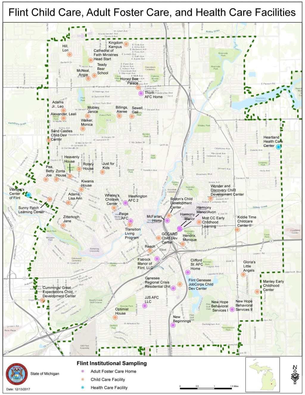
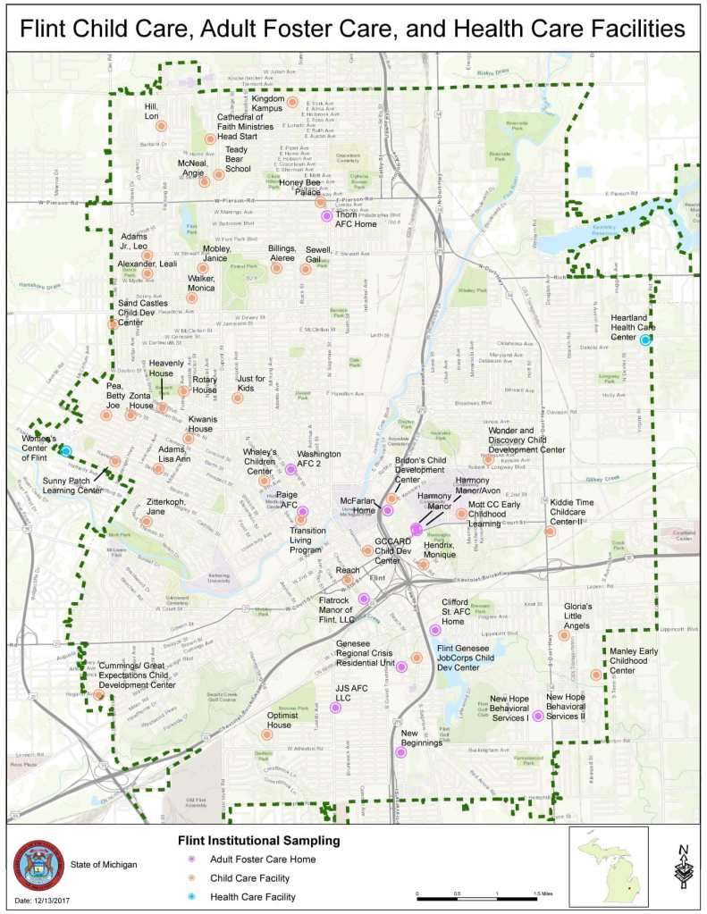
In 2016, I attended the Congress for New Urbanism event in Detroit, where data and tech startups were excitedly asking about the potential to buy up Flint real estate post-water crisis. I was surprised and appalled. I had already had family members move out of the city as quickly as they could, and there was still no clear solution or accountability. A 2023 study estimated that Flint properties lost $520 million in value as a result of the water crisis.
The Wall Street Journal recently published a story titled: “Investors piling into Flint’s dilapidated housing market,” specifically mentioning investors from New York, California, and Florida. The Wall Street Journal reported a 28% increase in Flint home prices, while the average home price is still around $200,000. Wards 3 and 6 have the most out-of-state taxpayers. Ward 3 has the most from Florida, and Ward 6 has the most from California.
This analysis does not dig into the ownership of LLC’s that are registered with a Flint address. A good example is the Flint Commerce Center LLC, which owns the former Buick City site and is run by Ashley Capital, the largest privately-held industrial real estate investment company in the US. Their main office is in New York City, with a Michigan office in Canton, Michigan. Overall, there are 4,547 LLCs listed as the primary property owner across Flint. Just 31% of those LLCs have a taxpayer address in Flint, and 27% have an out-of-state taxpayer address. The most common out-of-state taxpayer addresses come from Florida (701), California (637), Nevada (264), Texas (213), Georgia (187), and New York (153).
Not everyone utilizes an LLC to do their property purchasing and tax management. The overwhelming majority of parcels have taxpayer addresses in Michigan (95%), Grand Blanc is the top city (2%) after Flint proper (91%). McLaren Health, for example, has its properties registered to a Grand Blanc taxpayer address. Many corporations have their headquarters in other states. For example, GM has a Texas taxpayer address for the Flint Truck Assembly on Van Slyke. CSX rail company owns a good chunk of land and is based out of Florida. DPH Environmental Response Trust is the holding company formed after the Delphi Corporation went bankrupt and is based in Chicago, Illinois.
Produced for Flintside